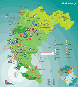
pulse sobre el mapa para ampliarlo |
||
 |
|
Coordenadas UTM **** 314485---4700709
By car:
From Catalonia and Levante
Ap2 (via Lleida) or A2 connexion with the N-230 in Lleida(Barrio de Balafa) exit 461 direction Vielha, by the N-230, you pass the following villages: Alfarràs,Benabarre, Puente de Montañana, Sopeira y el Pont de Suert (a 125 km of Lleida) afther 1,5 km of the exit of the Pont de Suert you get to a diversion, turn right, road L-500, after 1,5 km on the right you get to Camping del Remei.
From Madrid, middle and south of Spain
A2 and AP2 until Zaragoza, in Huesca the A23, Huesca, Barbastro via the N-240. After the N-123untill Berabarre connected with the N-230 (direction Valle de Aran) You pass the following villages : Alfarràs,Benabarre,Puente de Montañana,Sopeira y el Pont de Suert (a 125 km of Lleida) after 1,5 km of the exit of the Pont de Suert you get to a diversion, turn right, road L-500, after 1,5 km on the right you get to Camping del Remei.
From the North of Spain
Ap8 until France, on the A63 take the connection with the A64 (Bayonne), it’s the so called autopiste of the Pyrenees, exit nr 17 Montrejeau, follow the N125 to Saint Beat towards Spain by the Valle de Aran, when You reach Viella, follow the N-230 direction Lleida, after about 38 kms, You will find the diversion, there You turn right, this is the local road L-500, after 1,5 km You will find on Your right Camping del Remei.
| Distancies | |||
| Barcelona | 275 km. | Huesca | 148 km. |
| Zaragoza | 267 km. | Lleida | 125 km. |
| Madrid | 580 km. | Valencia | 489 km. |
| Ámsterdam | 1.377 km. | Brussels | 1.177 km. |
| Paris | 876 km. | Roma | 1.456 km. |
| London | 1.327 km. | Stuttgart | 1.358 km. |
| Toulouse | 201 km. | ||